It’s summer in Cleveland – and in this summer-loving city, that means many people frequenting our local beaches and hitting the trails.
Unfortunately, both of those places can get quite crowded on warm nights and weekends. If you’d like to enjoy the great outdoors near Cleveland while minimizing the chances of encountering other people, then the Buckeye Trail is the way to go!
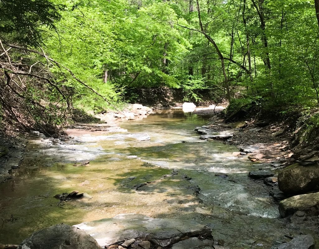
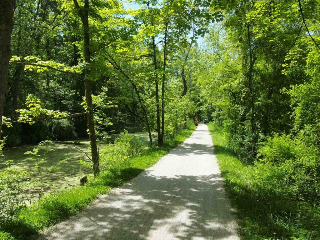
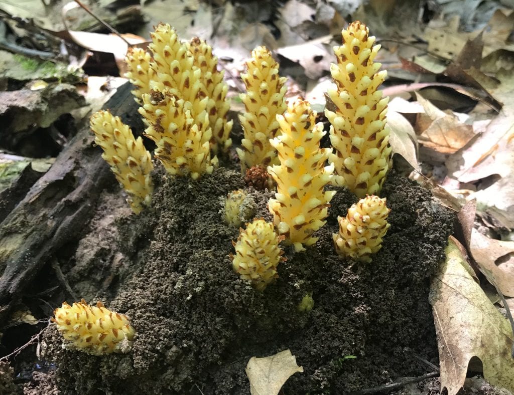
The Buckeye Trail takes you off the beaten path, meaning that you can spend hours hiking and see very few people. Plus, there are ample opportunities to spot wildlife, find the perfect outdoor picnic spot, and cool off in a creek.

So, while many people will be crowding around Brandywine Falls, you’ll be where those in the know go: the Buckeye Trail.
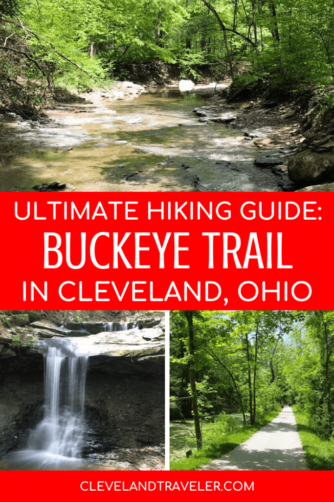
The Ultimate Guide to Hiking the Buckeye Trail Near Cleveland
What is the Buckeye Trail?
The Buckeye Trail is a huge trail system that encircles the whole state of Ohio – a total of about 1,444 miles! It winds through some of the most beautiful parts of the state, including areas of Cuyahoga Valley National Park and the Hocking Hills. Construction began on the trails in 1959 near Hocking Hills, and was completed in 1980 around Deer Lick Cave in northeast Ohio.
This massive trail system is maintained by the Buckeye Trail Association, a group of volunteers committed to improving, maintaining, and promoting this scenic path.
While it is relatively unknown to a lot of people, it is mostly used by avid hikers, trail runners, and occasionally those on horseback! It can be a bit challenging in some places with some steeper elevations and muddy trails, but, with the right equipment, you can enjoy this trail for yourself.

Where Can I Find the Buckeye Trail Near Cleveland?
There are a few sections of the Buckeye Trail that are easy to access from downtown Cleveland, including the Bedford section, the Burton section, and the Akron section.
1. Bedford Section
The closest section to downtown Cleveland is the Bedford section that begins within Brecksville Reservation in Brecksville and ends at Headlands Beach State Park in Mentor. It is about 65.8 miles, with 44.4 miles being off-road.
Here it winds through Cuyahoga Valley National Park and some Cleveland MetroParks like Bedford Reservation and South Chagrin Reservation. You’ll also have a chance to walk through Lake County MetroParks like Chapin Forest Reservation and even spot Lake Erie from Mentor Lagoons Nature Preserve.
2. Burton Section
This section is 56.9 miles long (30.5 off road), begins at Headlands Beach State Park, and ends at the Headwaters Trail near Hiram.
On this section of the Buckeye Trail, you’ll pass through Big Creek Park, Hiram Rapids, and even the quaint small town of Burton.
3. Akron Section
The Akron section also starts in Brecksville Reservation and then ends in Crystal Springs. Most of this section is off road with 51.8 of the 57.6 miles being in wooded areas. This is one of the more scenic sections as it comprises parts of both Cuyahoga and Summit MetroParks, as well as Cuyahoga Valley National Park.
Expect to see beautiful waterfalls, canals, and locks as you hike on this portion of the Buckeye Trail.
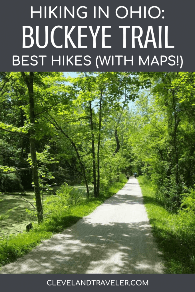
Best Hikes on the Buckeye Trail (with maps!)
While there are many places across the state of Ohio to jump on the Buckeye Trail and keep hiking, here are a few of our favorites to enjoy for a short hike or half-day hike near Cleveland.
1. Long Hike to Blue Hen Falls Starting on Snowville Road
For a longer and challenging day hike, look no further than this one. Park at the intersection of Vaughn Riverview roads before heading south along Riverview Road and hopping on the trail on Snowville Road. Take the Buckeye Trail south toward Blue Hen Falls.
You’ll stay on this trail the entire time until you see the sign for Blue Hen Falls. The total distance from Snowville Road to Blue Hen Falls is about 4 miles, so 8 miles for a there-and-back trip. Along the way, you’ll encounter some muddy paths and steep climbs, but the tranquility is definitely worth it! The hike averages about 724 feet in elevation gain.
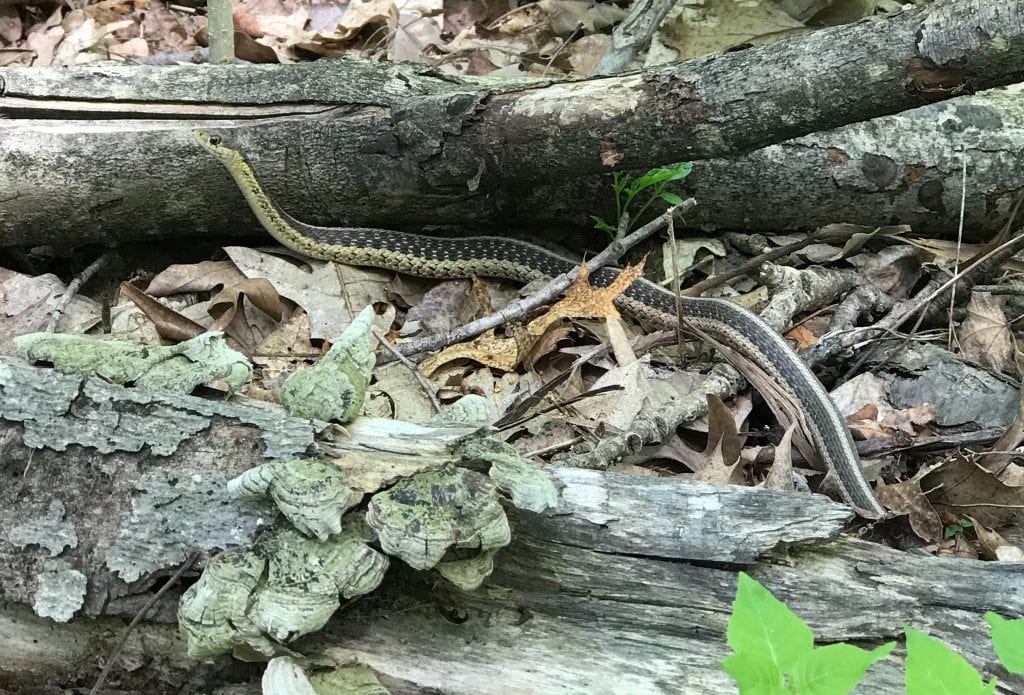
You will also likely spot some wildlife, ranging from deer to snakes and everything in between.
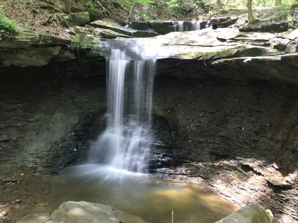
Once you see Blue Hen Falls, you can take a dip and cool off, or snap some photos around the area.
The total time for this hike is about 3.5 to 4.5 hours, depending on how many stops or breaks you take along the way, and how long you spend at the falls.
Pro-tip: Wear hiking boots for this section of the Buckeye Trail as it is super muddy and can be slick in some uphill and downhill spots.
2. Short Hike to Blue Hen Falls Via Boston Mills
There are plenty of reasons to want to opt out of the hike above: not enough time, hiking with kids, no interest in hiking 8+ miles, etc. Luckily, you can still experience the beauty of Blue Hen Falls and the tranquility of the Buckeye Trail without going to great lengths to do so.
This is only a little over a mile each way, or 2.25 miles total. This is a much easier hike as well with only about a 240 feet elevation gain. It is a happy middle ground hike that will only take you 1-2 hours.
Park at the Boston Mills Visitor Center and start the Buckeye trail going west for this hike.
3. Bridal Veil Falls to Tinkers Creek Gorge Overlook Hike
For a super quick hike along the Buckeye Trail, consider starting from Bridal Veil Falls and continuing up to Tinkers Creek Gorge Overlook. This 2 mile hike is easy with an 83 foot elevation gain, making it perfect for hiking with small children.
Park at the Bridal Veil Falls parking lot in Bedford Reservation, where you’ll catch the Buckeye Trail heading northwest toward the overlook. The trail should take about an hour or less to complete.
Take your time to enjoy the beautiful waterfall before witnessing one of the most gorgeous parts of Bedford Reservation.
4. Deer Lick Cave Hike
This is another quick and easy hike, with only about 89 feet in elevation gain; the Deer Lick Cave hike is perfect! At only about a hair over 2 miles, you can get a good hike in without spending all day on the trails. Expect to spend about an hour or less hiking to Deer Lick Cave and back.
This trail is a hybrid of the Buckeye Trail and Deer Lick Cave Trail, as you have to get onto the Deer Lick Cave Trail in order to see Deer Lick Cave and the waterfall. Start by parking at the Oak Grove Picnic area in Brecksville Reservation heading southwest near Valley Parkway until you find the Buckeye Trail.
Continue southwest on the Buckeye Trail until you hit a fork in the trail where you’ll turn right toward Valley Parkway. Upon crossing the road, you’ll be on Deer Lick Cave Loop. Take a left and follow the loop, then get back on the Buckeye Trail back toward the picnic area.
If you prefer, you could make this a longer hike instead by taking the trail beside Valley Parkway and taking a right onto the Deer Lick Loop Trail after Meadows Dr. This then merges onto the Bridle Trail before looping around to Deer Lick Loop Trail and cave. Then, you’ll get back on the Buckeye Trail toward the parking lot. This would be a little over 4 miles or 2 hours long.
The best part of either of these hikes is the cave itself and the waterfall just before it!
5. Red Lock and Boston Loop Trail
For a mix of challenging and easy walking, this is a great option within Cuyahoga Valley National Park! You’ll start at the same place as the first hike above on Snowville Road and go toward Blue Hen Falls. After reaching Blue Hen Falls, you’ll continue on your way, crossing Boston Mills Road going east on the Buckeye Trail until you reach the Boston Mill Visitor Center.
From there, you’ll go left on the Ohio and Erie Canal Towpath Trail, which is a pretty flat, paved or gravel route that’s easy to walk on. This follows the Cuyahoga River and the old Erie Canal, where you’ll get to see some old locks on your hike. After you cross W Highlands Road, go a bit further to see the Red Lock.
Then, head back toward W Highlands Road (which turns into Vaughn Road) and take a right. From there you can either stay on the road and get back to the parking lot near Snowville, or take the Buckeye Trail connecting trail to your left and end up on Riverview Road (close to where you started your hike).
This is about 8 miles and the first half is quite challenging (it’s the same as the first hike we mentioned to Blue Hen Falls). However, this is a loop rather than an out-and-back. The second half you will be on the Towpath, which is paved and flat. This will be about a 3.5-4.5 hour hike and you’ll have an elevation gain of 558 feet.
Pro-tip: As a heads up, the Towpath Trail can be quite congested, especially around holidays and weekends. Going midweek or earlier in the day is a great idea to avoid crowds.
Top Tips for Hiking the Buckeye Trail
Before hiking the Buckeye Trail, here are the things you need to know.
Note: This section includes affiliate links, meaning if you book/purchase something through a link, I may receive a small commission at no extra cost to you.
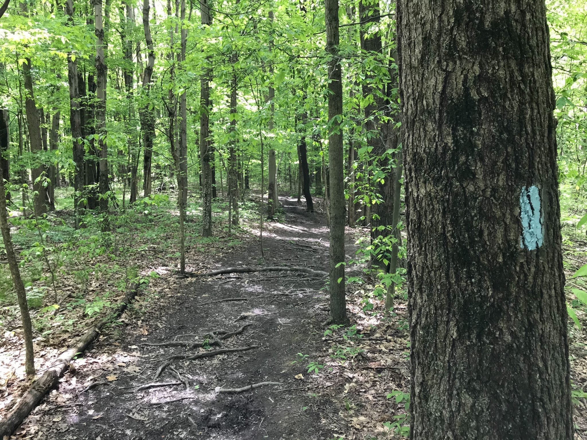
1. Follow the Blue Blazes
This is SO important so that you do not get lost while hiking on the Buckeye Trail. They paint the trees with a blue line at intersections and various points on the trail (shown below).

If it is just one line, it means to go straight. If there are two lines (one will be higher than the other), that is the direction you must take to stay on the trail. If there are two lines and none are above the other, then you go straight and pay attention as the trail may not be as clear.
2. What to Wear on the Buckeye Trail
While some parts are relatively flat or potentially paved, many of the trails closer to Cleveland tend to be very muddy, slick, and occasionally steep. I’ve made the terrible mistake of hiking in old running shoes, and was covered in mud afterward. Opt for some hiking boots instead for better traction. (Our favorite hiking boots are the Merrell Moabs, which come in waterproof versions for both men and women.)
Also, be sure to wear long pants, as you may encounter some poison ivy near the trail. While the trails are pretty well maintained by the Buckeye Trail Association, there can be a slight bit of overgrowth.

3. What to Bring in Your Day Pack
What to bring in your day pack definitely depends on how long you plan to hike. If you plan to be out for several hours, here are some key items to pack:
- Water. Lots of water. For the longer hike to Blue Hen Falls, 2 liters of water per person is a good idea, especially on hot days. For shorter hikes, a large water bottle should be good, but always pack more water than you think you’ll need. We love our Camelbak water bottles (especially this one, the Chute), or you could opt for a hydration backpack.
- Electrolyte tablets. For especially hot and humid days where you’ll be sweating, it’s a good idea to pack electrolyte tablets to replenish the sodium you’re losing. Just throw one in your water bottle and pack some with you.
- Lifestraw. If you happen to run out of water, this can be a life saver. You can use this gadget to drink from a stream safely – or you can even get a water bottle with a Lifestraw built in.
- Snacks. On long hikes, snacks are essential to keep you fueled. We typically pack sandwiches, bread, granola, fruit, etc. that will keep well during the hike.
- Sunscreen. Even under the trees you can still get a sunburn. Pack sunscreen to prevent burns. We like Sun Bum, which is vegan and eco-friendly.
- First aid supplies. You may not need to pack the whole kit, but having some essentials like hand sanitizer, bandages, etc. is helpful just in case.
- Extra pair of socks. Again, this is more relevant for longer hikes on the Buckeye Trail, but if you step in a big puddle of mud and you get your feet wet, it helps to have a change of socks that are dry.
- Bug Spray. This is good to keep on hand to prevent bug bites in the spring and summer months. Here’s a DEET-free bug spray that we like.
- Tick Key. While wearing long pants and hiking boots and sticking to the trail should prevent a tick from attaching itself to you, if you spot a tick on you, a tick key helps in removing it safely. The earlier you remove a tick, the better to prevent lyme disease. Also, be sure to check yourself after your hike for ticks.
- Compass. To prevent getting lost on the trail, a compass is a great tool to have!
- Bags. The goal is to leave the place as you found it (if not better)! So bring bags to either clean up any trash on the trail you see, or to keep your own garbage in to take out with you when you leave.
4. Leave No Trace
Please be respectful of the Buckeye Trail. It’s a beautiful and remote trail that is maintained by volunteers. Help them out by picking up trash on your hike, cleaning up after yourself (and if you bring your dog), and staying on the trail.
5. Consider donating to the Buckeye Trail Association
If you enjoy your hike on the Buckeye Trail, consider donating to help the volunteers maintain it. You can make a donation here.
Happy hiking, and we hope you enjoy this off-the-beaten-path trail in Cleveland this summer!
Have you ever hiked any parts of the Buckeye Trail?
Pin it for later:

Kat is a Cleveland transplant and has lived here for over 5 years. She loves to eat, drink, and explore all across the city, and has made it her personal mission to find the best breweries and pizza in Northeast Ohio. She also runs a couples travel blog and podcast called World Wide Honeymoon.
Hike #2 (Blue Hen Falls from Boston Mills Visitor Center) is only a little more than two miles round-trip. The written summary says that it’s four miles.
Thanks for catching that; you’re right, the out-and-back is only just over 2 miles.